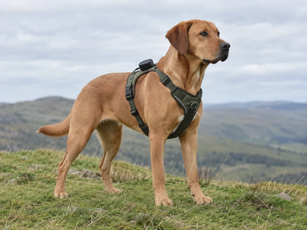
Every cellular pet tracker shares one weakness. When your dog runs past the last mobile mast, the device still knows where it is and can no longer tell you. At IFA 2026 in Berlin on September 9, 2026, SATELLAI showed a dog wearable built to close that gap. The Tracker Ultra pairs GPS positioning with a direct satellite link, using a Qualcomm 9205S modem on Skylo’s satellite network. The idea is sound and the physics is unforgiving.
What was announced, and what was not
SATELLAI introduced three things at IFA. The Tracker Ultra is a harness-mounted dog wearable that combines GPS with satellite connectivity, so position data can travel beyond terrestrial cellular coverage. The Cat Tag is a roughly 4 gram Bluetooth wearable for indoor cats, focused on activity and behavior. A previewed Cat Tag Pro would add LTE and GPS for cats that go outside, and both cat products are planned for launch by the end of 2026 in the United States, Europe and Japan.
The company did not publish a price, a release date or a subscription structure for the Tracker Ultra. Treat the device as announced and not yet on sale.
How a satellite link reaches a collar
The modem inside is the part worth understanding. The Qualcomm 9205S supports 3GPP Release 17 narrowband non-terrestrial network operation in the L and S bands, alongside conventional cellular and an integrated satellite navigation receiver. In plain terms, it is a low-power internet-of-things modem that can talk either to a mobile mast or to a satellite using the same standard.
Skylo supplies the satellite side. Its service runs over partner geostationary satellites operating in L band, with no low-orbit constellation involved. That choice has consequences you can calculate.
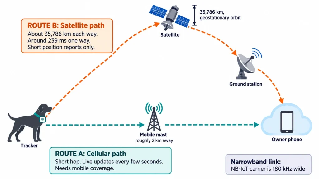
A geostationary satellite sits about 35,786 kilometers above the equator. Radio waves travel at roughly 300,000 kilometers per second, so a one-way hop from collar to satellite takes about 119 milliseconds. Add the hop down to a ground station and a single direction costs around 239 milliseconds. So a message and its acknowledgment need close to half a second before any processing happens, and the real figure runs higher because the slant path is longer than the straight-up distance.
Why that makes it a message service, not live tracking
Narrowband satellite links are narrow by design. An NB-IoT carrier occupies 180 kHz, and satellite operation trims the achievable throughput further. So the device sends short position reports, never a continuous stream.
That difference matters when a pet is missing. Cellular trackers offer a live mode that refreshes every few seconds while you walk toward the animal. A satellite link cannot sustain that. It tells you where the dog was at the last report, which is enormously better than nothing in a place with no coverage, but it is a different product from a live tracker.
Power is the second constraint. Reaching a satellite 35,786 kilometers away costs far more transmit energy than reaching a mast two kilometers away. Any sensible design uses cellular whenever cellular exists and falls back to satellite only when it does not.
Sky view is the requirement nobody mentions
A geostationary satellite sits in one fixed direction from your location, and the antenna in a small collar device has very little gain. The link needs a reasonably clear view of that part of the sky.
Skylo’s own terms state that performance depends on the environment, the device and its orientation relative to the satellite. The same terms note that satellite coverage is not complete, uniform or comprehensive worldwide, and that sanctioned regions are excluded. Those are honest caveats and they describe real limits.
Dense forest canopy, a steep valley, a shed roof or a dog lying on its side can all interrupt the path. The places where a pet most often disappears, meaning thick woodland and culverts, are also the places where both satellite and cellular positioning struggle.
Who this helps
Match the technology to where you lose a pet.
- Hiking, hunting and backcountry work, where mobile coverage ends
- Rural farms and estates with large dead zones between masts
- Remote holiday regions where roaming coverage is patchy
- Working dogs that range far from the handler
Now consider the common case. Most pets go missing in suburbs and towns, within a few streets of home, where a mast is already close. A cellular tracker such as the Tractive DOG 6 covers that scenario well, and its own product notes make the trade explicit: the working range is wherever mobile coverage reaches. For an urban owner, satellite capability solves a problem they do not have.
The cost question you should ask early
Satellite connectivity is not free airtime. Cellular pet trackers already run on a subscription, and over a dog’s life that recurring fee usually exceeds the hardware price. A satellite tier adds another commercial layer on top, because the operator pays for satellite capacity separately from mobile data.
Ask three questions before preordering. Does the satellite mode need its own plan or is it bundled? How many satellite reports are included per month? And does the device fall back to cellular automatically, or must you switch it manually? None of these answers exist publicly for the Tracker Ultra yet.
What to watch between now and launch
Two claims will be worth testing when hardware ships. The first is time to first fix in real terrain, because a laboratory figure taken under open sky says little about a wooded hillside. The second is battery life in mixed mode, since a device that spends a weekend hunting for satellites behaves very differently from one that sat on a home network all week.
Satellite pet trackers close a real gap, and the engineering behind this one is built on published standards, which bodes well for reliability. Still, the honest framing is narrow. This is coverage insurance for places cellular cannot reach, not a faster or more accurate way to find a dog three streets away.